Following the trail uphill into the trees, looking for the cache.
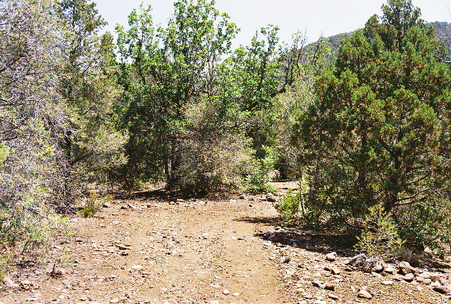
Our first trek of the day--Scott's idea--was up into the nearby hills for a bit of geocaching. This is a new sport where people use GPS receivers and waypoint coordinates downloaded from the Internet to find hidden caches of stuff. What's in the cache isn't so important as being able to find it. We left the truck near a dry creek bed and found a trail that climbed up through dappled pines. We started about half a mile from the cache and followed the trail up the hill. Good test for Lauri's new hiking boots.
The arrow on the GPS display told us when to leave the main trail, and after a dozen yards or so of slogging through the brush found the distance to the target increasing instead of decreasing. So we started looking around. I found the cache, hidden in a niche under a large rock, with smaller flat rocks leaning up against the larger rock to conceal the hiding place. The leaning rocks struck me as odd, unnatural, and that's what gave the location away. The cache consisted of a Tupperware container full of assorted knickknacks plus a ziploc bag with the log (and a printed explanation of geocaching should someone stumble onto the cache unknowingly).
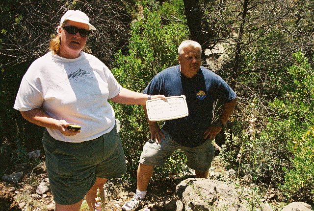
In geocaching, finders can add to the box as well as take things from it. We didn't change the contents, but we did sign the log. Then it was back to the road and back to the truck.
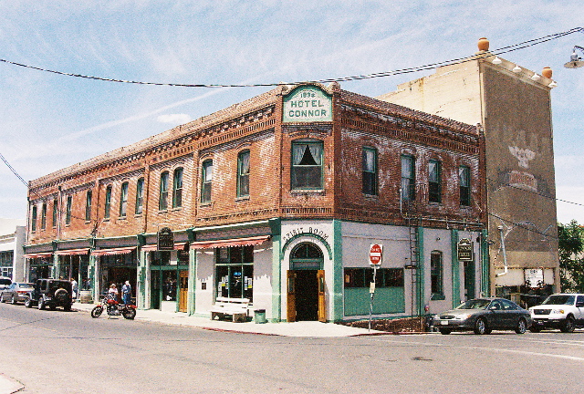
The drive to Jerome took us along a winding switchback up the mountain, hairpin curves and steep dropoffs. Jerome is an old mining town pasted precariously on the side of a cliff, between about 6 and 7 thousand feet in altitude. The view from the town is fairly spectacular, looking as it does over the red rock of Sedona in the distance. Scott had recommended lunch at one of Mary's favorite places, the Haunted Hamburger. No parking spaces available in the adjacent lot meant we had to drive around the next hairpin and walk up 3 flights of steep steps set into the face of the slope. It was then about noon, and we had a nice lunch. I ordered the namesake signature dish, a hamburger with grilled onions, green chiles (naturally), guacamole, swiss and mushrooms. Very tasty. Lauri had a less-adventurous version with just mushrooms and swiss called the Ghost Burger. Scott and Shannon tried the fish and chips; Mary had the chicken version of my burger. Sufficiently restored, we continued on our way, after Shannon pointed out the Hotel Connor, featured on the cover of a local performer's CD. I took a picture.
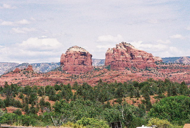
We descended out of Jerome to the open plain, which slopes gradually down to the north, the red hills always visible in the distance. Before we reached Sedona, however, we made a detour, a side trip off the road a few miles to Red Rock State Park. The park offers vistas of red rock formations, including the (supposedly) most-photographed scene in the state, which tourists call "Cathedral Rock." (Don't know what the natives call it.)
The park offers info on the ecology of the area, the wildlife and flora, environmental education, plus recreational activities such as hiking and picnicking. Oak creek runs through the park and I could have taken pix of the rock with water in the foreground--like on the postcard--if I'd taken the Bunkhouse trail down to the creek. But this was just a side-tour, so after some pictures outside and a bit of time looking over the offerings in the Visitor's Center (mainly to catch some air conditioning), we continued on our way down into Sedona. Lauri bought a jigsaw puzzle.
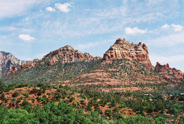
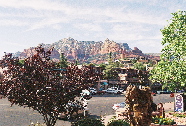
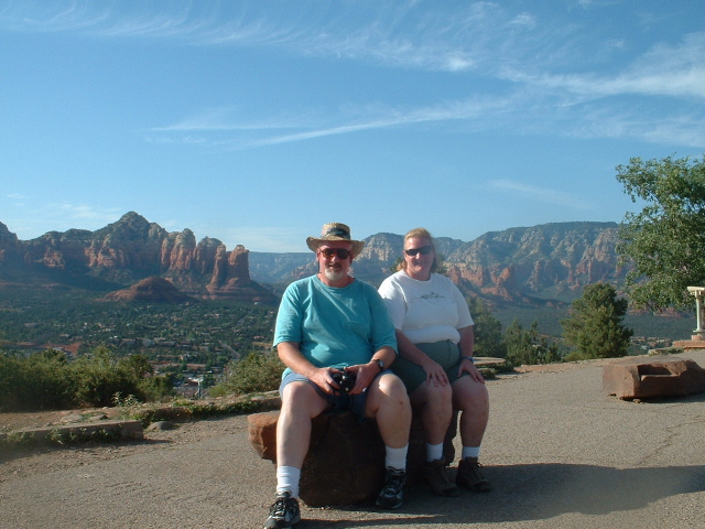
The famous red rock that Sedona is known for is highly localized. You don't have to travel very far from the town before you lose it. The city of Sedona lies mostly along the canyon drive. We drove almost to the N end, having come in from the SW, and stopped amidst the shops and restaurants that overlooked the rock formations to the east.
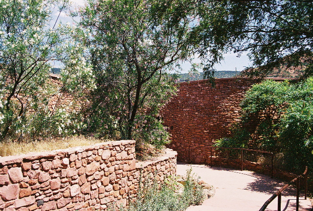
We spent the rest of the afternoon in Sedona looking through the shops. I found a t-shirt I liked; Lauri picked up some jewelry. And a puzzle. We wandered down the street, taking our time.
By then it had been several hours since lunch, so decided to continue walking until we reached the Cold Stone Creamery and get some ice cream. There was a line at the counter: apparently everyone else had the same idea. We sat out on the shaded patio overlooking majestic rock shapes and enjoyed our ice cream before setting off to explore the stores in this shopping center. Found a store advertising wine tastings. I'd just learned from a previous shop we'd strolled past that there were winemakers in Arizona. I was curious, so stopped in. Looked around first at the paintings on the walls (the store also serves as an art gallery). The proprietor said the featured artist was the hottest name in the art world right now. All the paintings featured wine, liquor, cards, dice or smoking--all the worldly vices (okay, almost all)--on backgrounds of solid flat black. I was reminded of Elvis-on-velvet paintings, but had the good sense not to say so. Anyway, the proprietor asked if I wanted to try some wines. What kind of a question is that? The cost was $10 for a half dozen Arizona wines and we got to keep the glass. I think by the time we were done we'd sampled 7 or 8, but that's okay. We stuck with the reds. I liked the syrah and the cab, and a blend called El Serrano. The others ranged from merely okay to somewhat funky. I picked up a bottle of the blend, either to supplement the one-and-a-half bottles remaining back at the condo, or to take it home and put it in the wine fridge for later. (Later I checked the wine label and discovered El Serrano was a California wine. The same vintner has wineries in Napa and Arizona. At first I was a bit disappointed that the wine I purchased wasn't local, but upon reflection remembered I had bought the wine I liked most, so the origin didn't matter.)
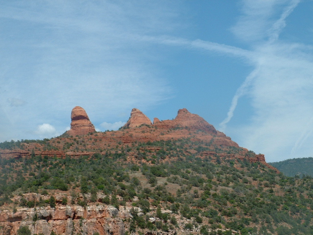
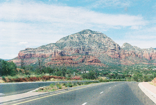
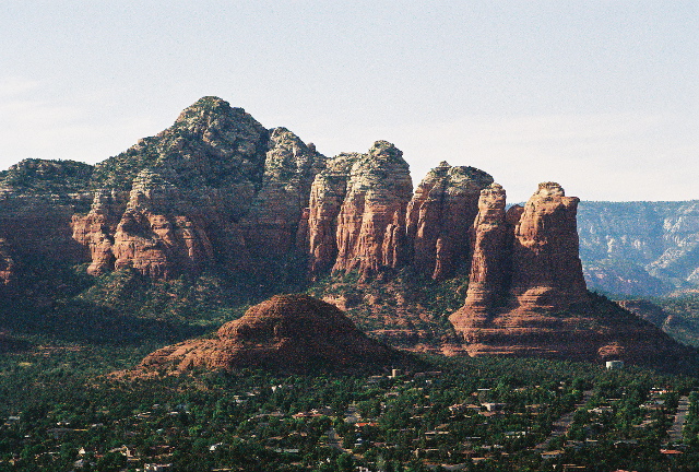
The main drag through Sedona does not provide a good vantage for taking pictures of the rock formations that tower over the city. It's too low, winding through the broad canyon: too many buildings and trees blocking the shot. Scott suggested we drive up to the airport, situated on a mesa on the south side of town, where the view would be better. So we hiked back to the truck and took the short but winding drive to the airport. As he said, good views.
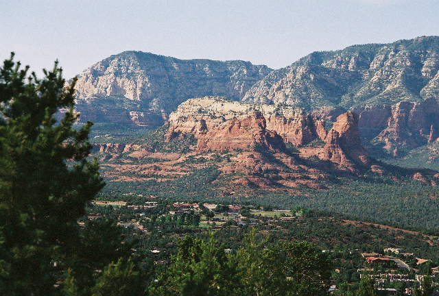
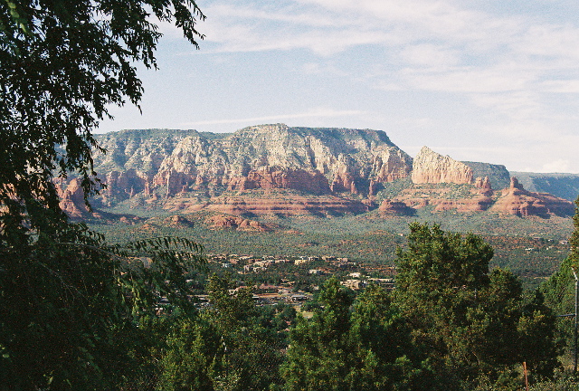
By this time the sun had moved low in the west, providing more intense color and deeper contrasts in the rock. Took my favorite Sedona picture from that spot.
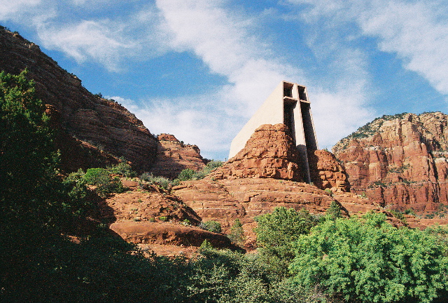
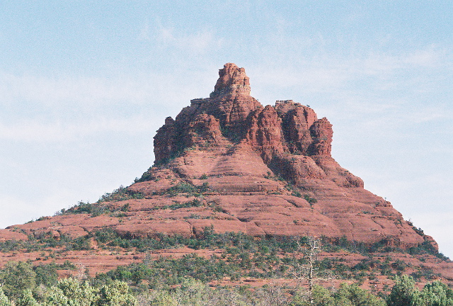
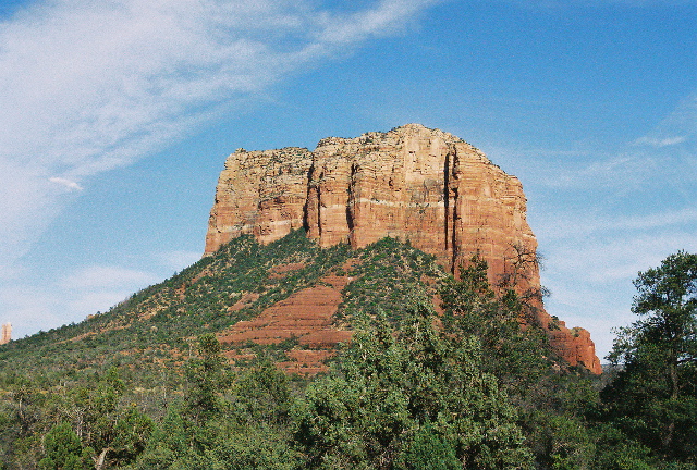
We took the scenic route back to Prescott Valley, past more rock formations, stopping every few miles (initially, anyway) to take pictures, including those of Chapel of the Holy Cross, Bell Rock, and Courthouse Rock.
Eventually we met up with I-17 and took the freeway to the PV exit (farther north than the exit we'd used that morning) and headed back to his place. On the way, we went through 3 distinctly different terrains/landscapes, not counting the red rock of Sedona. Arizona is like that, Scott said.
Had the nickel tour of Prescott Valley on the ride to the house. We said our goodbyes and were on the road about 7:15, the sun setting over the western hills as we drove out of town. I wanted to be back on the freeway while there was still daylight. Made good time, found the exit from 17 to 101 at 8:15, just an hour after pulling out of Scott's driveway. It was only 20 minutes from there to the Hayden Road exit and the condo. Time for a brief swim, to help loosen up the leg muscles from all that hiking and walking. And then to bed, but not before I added to the journal.